
Saturday, February 6, 2010
1961 Arlington Heights Zoning Map
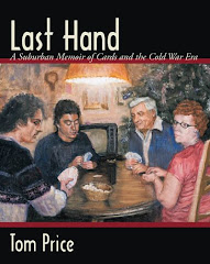
While writing the book, Last Hand a Suburban Memoir of Cards and the Cold War Era, I discovered an old 1961 zoning map my dad had obtained (probably around the time he put his down payment on the house in Greenbrier in October 1961). What is interesting about the map is that it captures a moment in time when Arlington Heights was expanding. Greenbrier, which is at the very top of the map, is the first area north of Palatine road that Arlington Heights annexed. This was also a time when Route 53 was still in the planning stage. Click on the image for a full view.

Subscribe to:
Post Comments (Atom)


2 comments:
Very Interesting! I am an American Studies Scholar at UMN Twin Cities and grew up in Arlington Heights. One of my committee members is Elaine May she is a scholar of the Cold War and suburbia!
I believe you'd enjoy the book since in addition to being a story of an American suburban family it tells the story of the changing community both from a personal perspective as well as a historical perspective.
Post a Comment