Sunday, December 27, 2009
Take Me Out to the Ball Game
When I was ten years old my dad took the family out to Wrigley Field to see the Cubs play the Cincinnati Reds. The date was July 28th and it was a remarkable game. It was remarkable for several reasons; one was both the Chicago Cubs and the Cincinnati Reds had some all time great players including Pete Rose and Johnny Bench for the Reds and Bill Buckner and Bruce Sutter for the Cubs. The other reason was the game turned out to be one of the longest and highest scoring games in Cubs’ history. After thirteen innings, several hotdogs, a container or two of Borden’s Frosty Malt, the Cubs won the game 16 to 15. I came across the old 25 cent program today. Attached is an image of the inside page—click on the image to get a better view.


Tuesday, December 15, 2009
The Area North of Greenbrier
During the early 1970s the area around Greenbrier began to expand. One small development of single family homes called Cedarbook was added almost as an extension of the original Greenbrier neighborhood. One project that was never completed was called Randhaven. Randhaven was to be multi-family housing units not too different from Greenbrier Apartments. But the builder ran out of money and as seen in this view of the area in 1975 the buildings were left unfinished. There they stood for several years. As a kid they presented just another adventure. As I talk about in Last Hand there were many things to do in the Greenbrier area such as unauthorized fishing, roaming the nursery, and going to the White Hen. Rand Haven was unique because it was like having your own local war ruins. Most of the buildings were void of any roofing, all that stood there was concrete, bricks and some stone rubble. If you had the nerve to enter one of those death traps, you'd also find the rusty iron stairwells to climb. The days of adventure with Randhaven lasted several years. Eventually the area would be cleared and build up at the Pointe Apartments.
Click on the picture for a closer view.

Click on the picture for a closer view.

Saturday, December 5, 2009
Seasons Greetings
My brother Steve would typically send out some creative Christmas cards. This one was probably from 1985 or so when he was still in his dragon phase. Note the dragon drawn sleigh.


Sunday, November 8, 2009
Book Signing and Discussion at the Arlington Hieghts Memorial Library
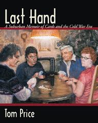
You can register now for the book discussion and sale of Last Hand: A Suburban Memoir of Cards and the Cold War Era at Arlington Hts Memorial Library on Nov. 19th here: http://tinyurl.com/yhdhxdn
I hope to see you there.

Friday, October 23, 2009
Last Hand Book Discusions, Signings, and Sales in November
Saturday, November 7, 2009 - The 2009 Sugar Plum Holiday Market
Time: 10:00am - 1:00pm
Location: Bell-Graham Elementary, 4N505 Fox Mill Blvd. St. Charles, IL 60175
Friday, November 13, 2009 - Holiday Shopping Extravaganva
Time: 6:00pm - 9:00pm
Location: Juliette Low Elementary, 1530 Highland Ave. Arlington Heights, IL 60005
Thursday, November 19, 2009 - Last Hand: Book Discussion and Signing
Time: 7:00pm - 10:00pm
Location: Arlington Heights Memorial Library. 500 N. Dunton Avenue Arlington Heights, IL 60005
Saturday, November 21, 2009 - Last Hand: Book Discussion and Signing at Read Between the Lynes Bookstore
Time: 1:00pm - 4:00pm
Location: 129 Van Buren Street, Woodstock, IL
Learn about my book discussion at the Arlington Heights Rotary Club on October 8th here: http://tinyurl.com/yz6rqbv
Time: 10:00am - 1:00pm
Location: Bell-Graham Elementary, 4N505 Fox Mill Blvd. St. Charles, IL 60175
Friday, November 13, 2009 - Holiday Shopping Extravaganva
Time: 6:00pm - 9:00pm
Location: Juliette Low Elementary, 1530 Highland Ave. Arlington Heights, IL 60005
Thursday, November 19, 2009 - Last Hand: Book Discussion and Signing
Time: 7:00pm - 10:00pm
Location: Arlington Heights Memorial Library. 500 N. Dunton Avenue Arlington Heights, IL 60005
Saturday, November 21, 2009 - Last Hand: Book Discussion and Signing at Read Between the Lynes Bookstore
Time: 1:00pm - 4:00pm
Location: 129 Van Buren Street, Woodstock, IL
Learn about my book discussion at the Arlington Heights Rotary Club on October 8th here: http://tinyurl.com/yz6rqbv
Wednesday, October 7, 2009
Arlington Heights Rotary Club
I will be discussing my book Last Hand: A Suburban Memoir of Cards and the Cold War Era at the Arlington Heights Rotary Club tomorrow at 12pm. Details at the Triblocal link below
Local Author to discuss his memoir about growing up in Arlington Hts at Rotary Club
Local Author to discuss his memoir about growing up in Arlington Hts at Rotary Club
Monday, September 28, 2009
Suburban Growth
One of the side stories in the book Last Hand: A Suburban Memoir of Cards and the Cold War Era is the rapid suburban growth during the 1960s. Between 1950 and 1970 the population of Arlington Heights grew 640%. This led to the doubling of the number of schools in Arlington Heights Elementary School District 25. Around 1975 the population leveled off and the number of school aged children dropped rapidly as families in the area aged. Two aerial photos show this growth one of Greenbrier and surrounding area in the Spring of 1963 and the other seven years later in 1970. Both pictures are in the book and provide glimpse at the growth during that period. I’ve added a third photo here of the same area in 1975, so that you can compare them. Some things to look for are the addition of Route 53, Greenbrier School, and Rand Jr. High (Only 3 pods complete) between 1963 and 1970. Click on the photos to get a better look.
Note: The street running through the center of Greenbrier in 1963 is Verde Drive. The two schools are not marked in the photos because when I made them for the book the print would have been illegible.


Note: The street running through the center of Greenbrier in 1963 is Verde Drive. The two schools are not marked in the photos because when I made them for the book the print would have been illegible.


Subscribe to:
Posts (Atom)